

|
Suitability Mapping system |
|
AFSI |

|
|
|
Suitability Mapping system |
|
AFSI |
|
The suitability for greening in current context places significance of using wastelands (under productive lands) as derived for remote sensing approach coupled with limited ground truth for taking up Agroforestry along with existing land use pattern. The statistics derived here should be construed in the sense of Wastelands being put to greening as alternative land use. The Study involves multi thematic GIS oriented weighted overlay analysis approach has been conducted for entire Indian region, except for minor geographic units of Union Territories of Lakshadweep, Dadra Nagar Haveli, Daman & Diu, and Andaman & Nicobar Islands (Fig. 1).
Major theme layers such as wastelands, land use/cover, soil carbon, waterbody and slope are considered in the present study. All the layers corresponded to a scale of 1:50000 which translate in to results that can be perfectly suited for strategic decisions at district level.
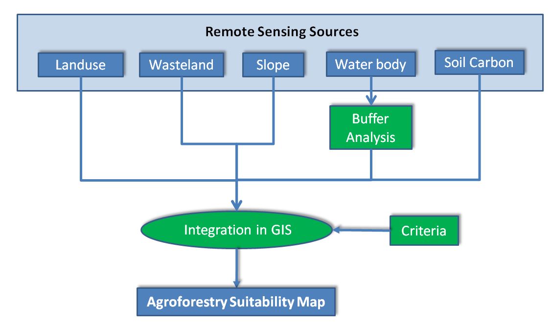
Fig. 1: Systematic diagram of methodology used in the study.
The thematic datasets used in the study are prepared under various national initiatives for land use & land cover, wastelands, slope, surface water and soil organic carbon. These parameters were used for GIS analysis-based prioritization.