|


|
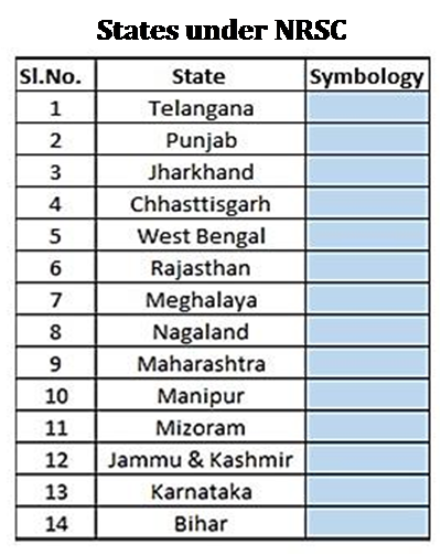
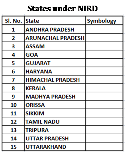
Pradhan Mantri Gram Sadak Yojana (PMGSY) under the Ministry of Rural Development was conceptualized and launched on 25th December, 2000 as a centrally sponsored scheme, with the broad objective of sustainable poverty reduction in rural areas. The main objective of PMGSY is to provide basic access by way of single all-weather road to all eligible unconnected habitations in the Core Network. Under PMGSY, approx. 6,26,034 km of length has been constructed till 31st March 2020. It is a challenge to manage such a gigantic activity using traditional methods, which is not only tedious and time-consuming but also difficult to ensure timely retrieval of the desired information. To overcome these difficulties, the use of Geo Informatics is taken up to help in effective planning, decision making and monitoring of PMGSY roads. The Tripartite Agreement on Use of Geo Informatics in Rural Road Projects under Pradhan Mantri Gram Sadak Yojana (PMGSY) was made and executed at New Delhi on 7th March, 2017 between National Rural Infrastructure Development Agency (NRIDA), National Remote Sensing Centre (NRSC) and Center for Geo-Informatics Application in Rural Development (CGARD). Under this project National Remote Sensing Centre (NRSC) and National Institute of Rural Development (NIRD) has jointly taken up to produce geospatial datasets for the country. This project is to extract and identify roads connectivity status in terms of length based on inputs provided by NRIDA. This includes generating a spatial database on road connectivity with respect to habitations connected under completed roads. Hence, it is essential to generate a rural road map based on satellite imagery for the roads sanctioned from the year 2000-01 onwards for further investigation and analysis. |

